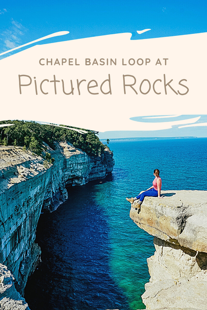
When visiting Pictured Rocks in Munising, Michigan there are several ways to enjoy the beauty of this area. You can view the famous rock formations from the water while on a boat tour or get up close while paddling in a kayak. Many waterfalls and overlooks are easily accessible from a short walk to an overlook, or even right along the roadside in some cases. But, if you're in search of the best way to experience Pictured Rocks (in my opinion) you'll want to conquer the 10-mile Chapel Basin Loop trail.
I will admit that initially I wasn't sure I wanted to do the entire hike because I had never completed a trail that long before, but I am SO glad we decided to just go for it. You can make the hike shorter by going out and back to Chapel Rock/Beach which is just over 6 miles, but some of the best views are past this point and I would have been very disappointed if we didn't do the entire hike. And don't let the distance scare you, the trail is well marked with minimal elevation gain so it really wasn't that strenuous. I've completed much harder hikes that were far fewer miles. Keep reading for everything you need to know if you plan to hike this breathtaking trail! Disclosure: Some of the links below are affiliate links which means I earn a small commission if you make a purchase which allows me to keep sharing my adventures with you!
Getting There
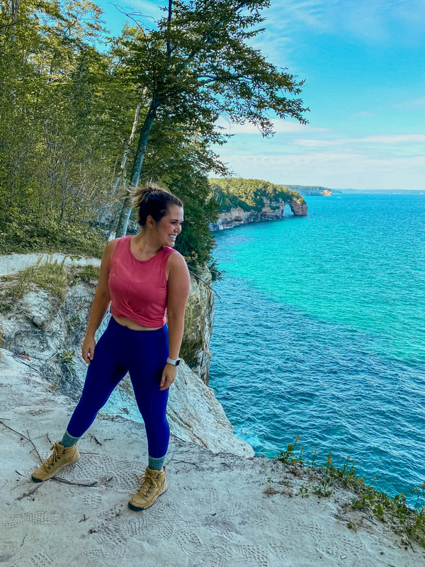
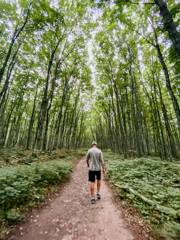
You'll access the trailhead from Chapel Basin Parking Lot. Once you turn off the main road you will need to take a dirt road for quite some time before you get the parking lot. The NPS was recommending people not travel on this road due to rough conditions (which we didn't realize until after the hike) but it really wasn't that bad. Don't get me wrong, there were definitely some larger pot holes in places but we were the only car on the road on the way in so it was easy to swerve around them. Which leads me to my next point, get to the parking lot early. I can not stress this enough! We arrived at the parking lot at 8:30am and there were still several spots available. When we were leaving, there were cars lined a half mile or more down the road (which just adds to your already long hike). And since this is such a long hike for most people (it took us just over 5 hours) cars aren't coming and going as often as some other parking areas. What to Wear We hiked the trail in mid-August but because it's so far north, the Munising area does have chilly mornings. I would suggest dressing in layers and bringing a light jacket to start the day which you can easily remove. If there is a chance of rain in the forecast when you visit, keep in mind 85% of the trail is through the forest which provides decent coverage. We only ever experienced a few light showers during our hike and never really got wet because of the trees. My other biggest tip is to wear decent shoes, preferably hiking boots. I can't tell you the number of tree roots I kicked along the way and am so glad I wasn't wearing sandals. You will stop at two beaches along your hike, so you could pack water shoes or sandals to change into if you wanted to take a dip in the water.
Hiking the Trail
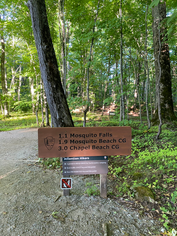
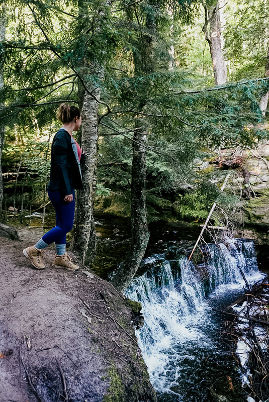
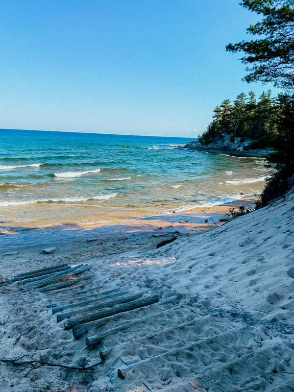
From the parking lot you can choose to go toward Chapel Falls (right) or Mosquito River (left). It doesn't really matter which way you go as you'll see the same sights, but I would recommend hiking clockwise (starting with Mosquito River/Falls). This is the way we went and it seemed to be the less popular choice but that's what we loved about it. It was so peaceful and for the first half of the hike we only ever encountered a handful of people. If you choose this route, the first stop you'll come upon in one mile is Mosquito Falls which features two drops with the upper at 10 1/2 feet and the lower at five feet in height. From there the next 1.5 miles are hiking through the forest until you cross Mosquito River and then get your first views of Lake Superior at Mosquito Beach. There is a short set of stairs you can take down to the beach to take a break before getting back on the trail.
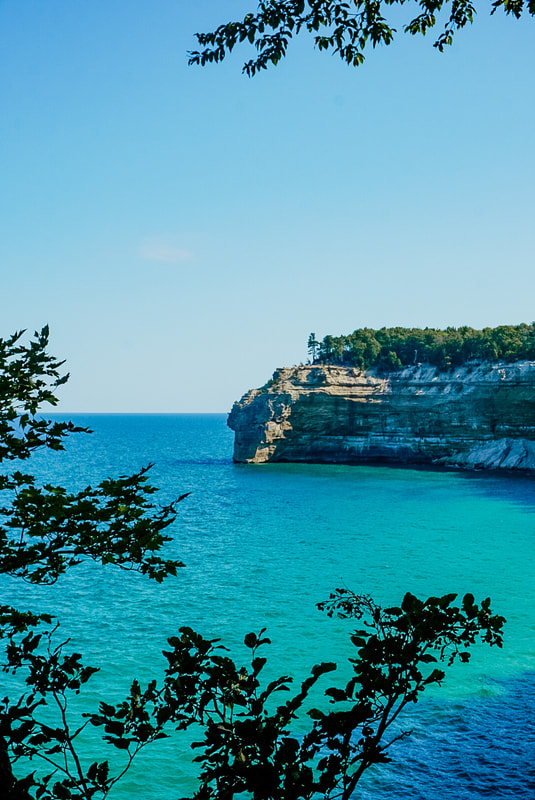
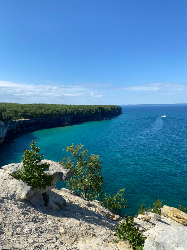
The next 2.7 mile stretch is my favorite part of the hike. The trail runs right along Lake Superior above the sandstone cliff and offers countless overlooks with stunning views. The majority of the trail is still in the forest so be sure to pop off the main trail at the different lookouts to check out the views of Lover's Leap and the iconic Indian Head which looks like the silhouette of a Native American wearing a headdress. It's also important to note that some sections of the trail run very close to the edge of the cliff and can be dangerous so always be aware of your surroundings and watch where you are stepping.
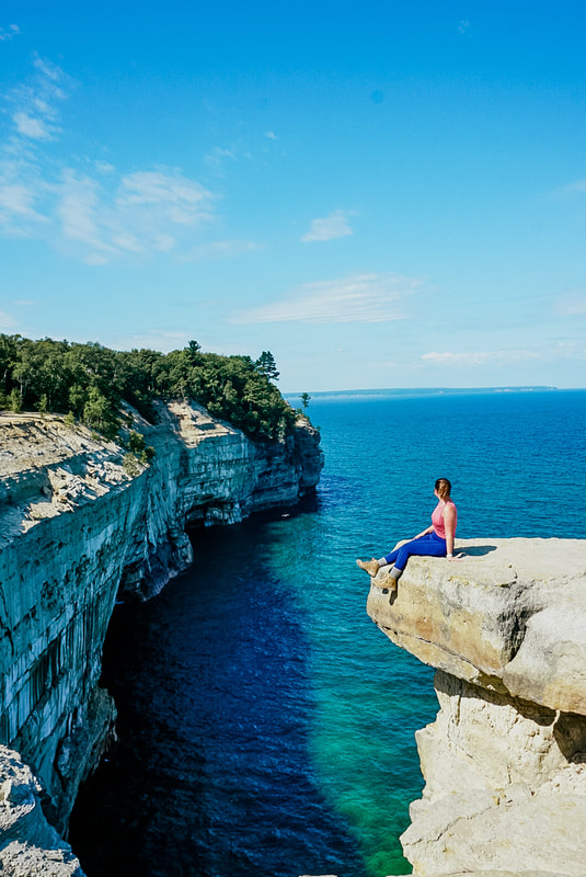
Next you'll reach the most epic part of the hike - Grand Portal Point! The views here are absolutely incredible and you can walk out on the top of the cliffs. This was a great spot to take photos, enjoy a snack, and soak in our surroundings. Another advantage of going early was we were at this lookout with only four other people so we really had the place to ourselves and got to truly enjoy Michigan's beauty.
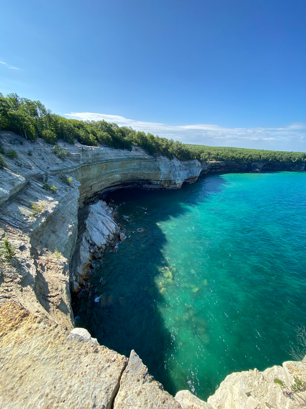
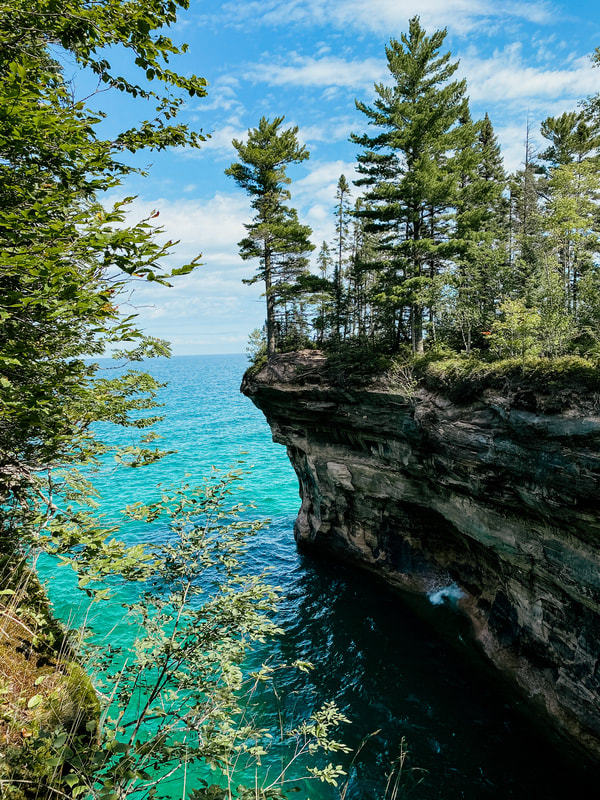
When you're back on the trail you have another 1.7 mile hike until you reach your next notable stop - Chapel Beach. Along the way you'll see some stunning lookouts including Chapel Cove. Seriously, I can't say this enough - be sure to hop of the main trail as much as possible as the views just keep getting better. If you're hiking clockwise you'll reach the beach on end farthest from Lower Chapel Falls and Chapel Rock. If you're wearing hiking boots like I was, and don't want to walk across the entire beach, you can keep hiking on the main trail. There are four or five different sets of stars that you can take down to the beach which will prevent you from filling your shoes with sand.
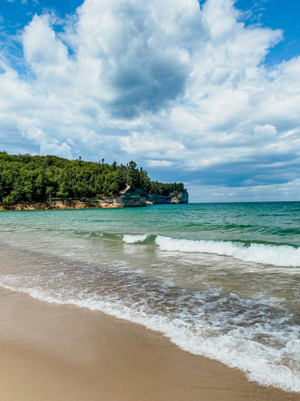
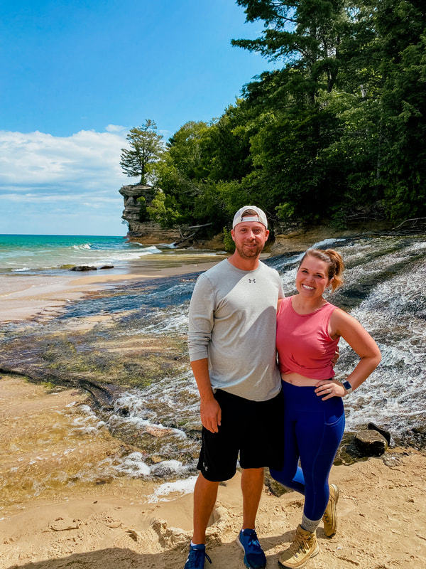
This is another great spot to take a break, or a swim if you're feeling daring! Many people who choose not to hike the entire loop will hike out to the beach and back so this is definitely where we saw the most people but still wasn't out of control. Toward the end of the beach you'll see Lower Chapel Falls which flow directly into Lake Superior. You can also get a unique view of Chapel Rock in the distance.
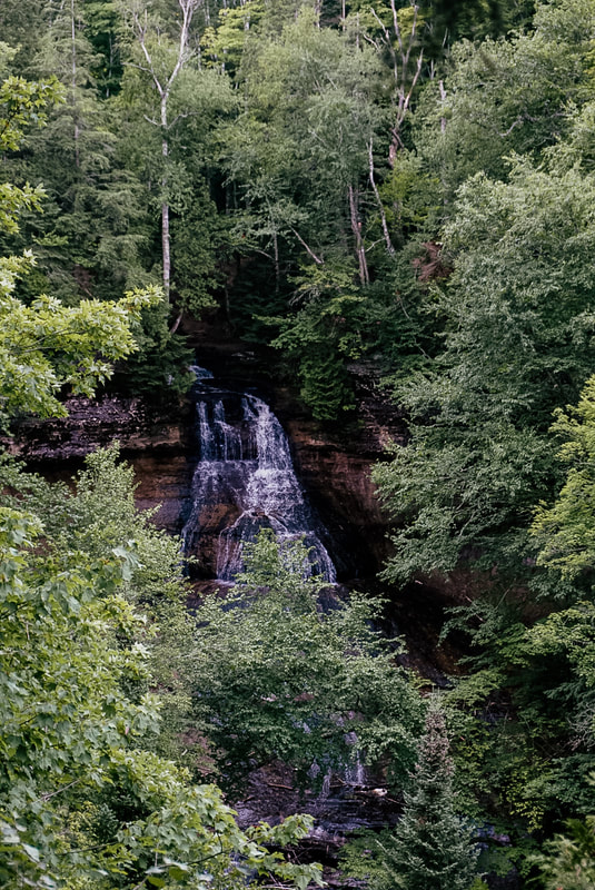
A short hike up from the beach will take you to the famous Chapel Rock which is home to a lone white pine estimated to be about 250 years old. There once was an archway connecting the rock to the mainland but the arch collapsed in the 1940s and the root system of the tree now stretches back across to the main cliff. This was the only area where we had issues with crowds as there were three or four groups at the top of the rock trying to take photos so we just snapped a quick one and left. A neat site to see, but certainly not the highlight of the trail for me. From here, you'll hike 1.9 miles through the forest until you reach the last notable stop, Chapel Falls. The falls can be seen from a viewing platform across the basin which is where the photo below was taken and you can also stand near the top of the falls on the 60-foot cliff.
The last 1.2 miles of the hike are fairly boring as there aren't any more stops to make and at this point my feet were very sore. We were on this leg of the trail around 12:45p and passed several groups hiking in to go to the beach. I won't like when I say I was happy to be back at the car, but so glad we decided to conquer this trail. If you're heading to Pictured Rocks this is truly one of the best ways to experience the area. We also did a boat tour the following day and it was neat to see all the places we had been on land from the water.
1 Comment
David P Dietlein
5/26/2024 08:34:17 am
Very informative story. Thanks. What day of the week did you hike to Chapel Beach. We are going in mid July on a Sunday. Do you know if the Chapel Basin parking lot fills up early all summer? Thanks.
Reply
Leave a Reply. |
AuthorI love creating detailed travel guides to ensure you get the most out of your time. On this blog I'll be sharing some of my past trips in hopes that it helps you plan your next adventure. Pack your suitcase you never know where I'll be heading next! Archives
September 2023
CategoriesAll 1 Day Itinerary 24 Hour Itinerary 2 Day Itinerary 3 Day Itinerary 4 Day Itinerary 5 Day Itinerary Arizona Asheville California Charleston Day Trip Denver Drink Guide Excursions Fall Travel Financial Tips Florida Food Guide Fort Wayne Gatlinburg Girl's Trip Grand Rapids Hawaii Hiking Hocking Hills Holiday Guide Indiana Kalamazoo Kauai Mackinac Island Maine Maui Michigan My Favorite Things Nashville National Park Northern Michigan Oahu Ohio Packing Tips Pet Friendly Product Review Savannah Sedona Sister Trip South Bend Southwest Michigan St. Louis Tennessee Texas Travel Gift Ideas Travel Planning Traverse City Upper Peninsula Virginia Wall Murals Winter Travel |

 RSS Feed